Welcome to Ohto County. Let’s Take a look around.
“Ideas, philosophy, art, culture. They live and die by the meme… An infection.”
—Izuru Kamukura, Danganronpa 3, Episode 11
You stand here in the fictional ocean mists of the Coast Roads. And you are no doubt wondering what you should do now. The previous page made a lot of big claims. So now I must make good on those claims. So here goes. At this stage in the game (and everything is a game, just as everything is a story) I recommend that you look around the Map of Ohto County. Get a feel for the districts and dirt roads.
The Basics
Ohto County is a coastal community, based loosely on the coastal community of the Sunshine Coast in BC, where my wife and I spent our Honeymoon, but blended with a kind of Stephen King / Lovecraft Country New England vibe (with Lovecraft’s rampant bigotry removed obviously). Ohto County exists somewhere on the west coast of North America, but precisely where is never made clear. People do not arrive in Ohto County willingly, they get lost and end up on the coast roads leading into the coastal delta. The region has a host of supernatural stories and folklore and local cryptids. As well as a multi-generational feud between the two most powerful families to originally colonize the region: The Linna Family and the Sundberg Family.
The Major Regions
Ohto County is divided in to two major regions: the western coastal region called the Ohto Lowlands and the eastern highlands known as the Elder Warrens. Within the Ohto Lowlands (also called the Karhu Delta Region) are the Broken Coast and New Vaarashire- which is the largest town in the region.
The Elder Warrens sits south and east of the Katketty River. To the east of New Vaarashire is the Lesser Hirvi Mountain Regional Park, and the tiny mountain villages of Old Taikus and Old Lincoln. Directly south of New Vaarashire is the Katketty River Region, itself divided into the low income rural South Shore Region, and the Lakeshore Region- which sits between the Ohto Lowalands, the Katketty Rivier region, and the Lesser Hirvi Mountain Regional Park.
The Karhu Delta Region is the most populace region of Ohto County, containing the town of New Vaarashire, in addition to the Broken Coast. The locals of New Vaarashire see themselves as the true people of Ohto County and as keepers of the history of the valley. The Katketty River Region is the disreputable impoverished region of Ohto County. The residents of the Katketty see themselves as the unappreciated backbone of Ohto County who hold New Varrashire together despite the laziness of the townsfolk who live there. The Lesser Hirvi Mountain Regional Park is the rural boondocks of Ohto County. The Hirvi folk distrust the Katketty folk and the New Vaarashire townsfolk and each other. People don’t move to the Lesser Hirvi, they retreat there with guns drawn against a world they mistrust.
The Demographics
Ohto County was colonized initially by a group of Norwegian and Finnish settlers, but the population now is composed of the lost wanderers who ended up in Ohto County through no fault of their own. And as such, the character of Ohto County is profoundly multicultural and diverse. Loyalties in the County are determined by which of two families one allies with, and whether one is a Townee (lives in New Vaarashire), a Katty (lives in the Katketty Region) or one of the Hill folk (lives out in the Lesser Hirvi Mountains).
The Ohto Lowlands
Ohto County is divided into the Ohto Lowlands and the Elder Warrens.
Most in the inhabitants of Ohto County are trapped in the Lowlands, hemmed in by rising alpine regions of the Elder Warrens. Few brave or foolish fools make their stand on the Broken Coast, most huddle in the New Vaarashire Region.
Marked by scrub grass and dusty soil through much of the region, the Lowlands is never the less mark the most fertile region of Ohto County. And the Lowlands are likewise home to the most unsolved disappearances and cult activity.
The Karhu Delta Region
The Karhu Delta Region dominates the Lowlands, and all lost souls find their way into Ohto County through the Delta. The coastal Delta region is marked by glacial rocks that have built up in deep furrows along the landscape, with brackish salt water which has escaped from coastal tide pools. A bizarre mix of desiccated forests and stagnant brackish marshlands, the delta is an unforgiving place where little grows that humans would consider beneficial. The inland delta region is dominated by New Vaarashire: the largest settlement and unending purgatory for a majority of the those who call the County their prison.
The Broken Coast

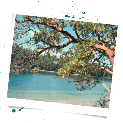
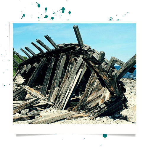
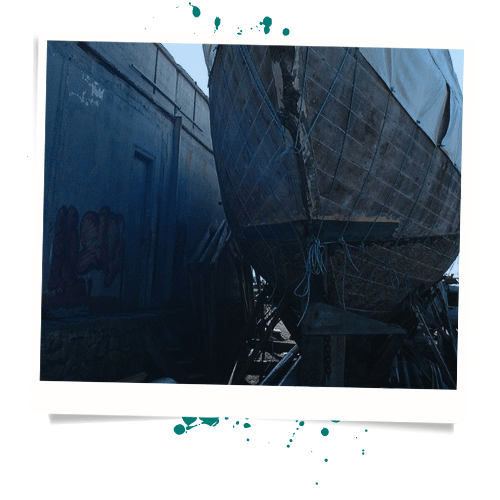
Locals joke that nobody knows for sure whether the Broken Coast was named for the jagged rocky salt stained sea cliffs that line the coast, or the wrecked sailing vessels that dotted the coastline in earlier eras of the county’s history. Many of the ancient shipwrecks still sit crumbling where they were beached so long ago. The coast is home to an infestation of Arbutus trees, with peeling bark coated in salt spray all along the craggy roadside of the Sundberg Coast Road.
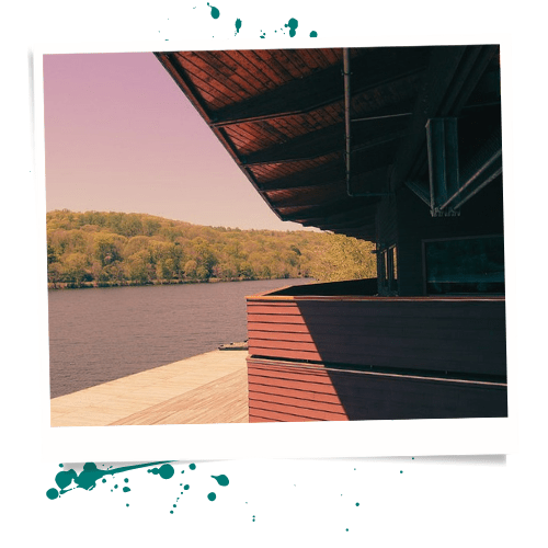
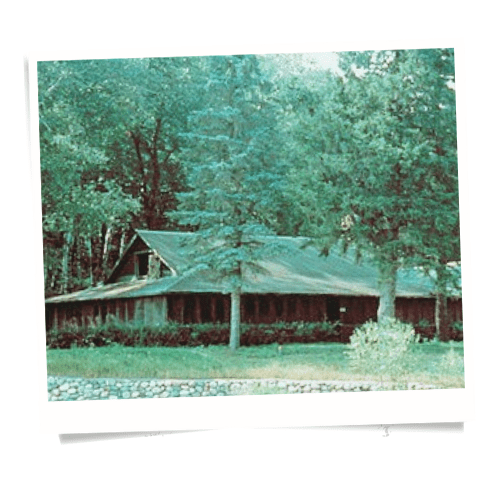
The Green Brothers Marina and Lodge
The Green Brothers Marina and Lodge is a small fishing lodge and Marina on the Broken that serves as the point of entry by air and by water for those entering Ohto County. Rundown, but well loved and still holding together, The Green Brother’s Marina and Lodge has been run by the Green family since the 1850s when the original Green Brothers founded it.
The Lokki Point Lighthouse
Lokki Point sticks out from the Broken Point and shelters the Karhu Delta and the mouth of the Katketty River. On the end of the point stands the Lighthouse. The Lokki Point Lighthouse is startlingly new compared to much of Ohto County. The Lighthouse has been rebuilt no fewer than five times since the founding of New Vaarashire. The Lighthouse seems a magnet for disaster, with previous incarnations having being devastated by a lightning storm, a collapsed portion of the point, two mysterious fires, and a completely unexplained collapse of the structure in 1913.
The Old Lokki Point Crossroads
Historically crossroads were a place where humans could deal with spirits and demons and devils. Old Lokki Point Crossroads is just such a place. Local legend say that Old Man Linna was buried beneath the crossroads after Lady Sundberg had him secretly poisoned, stabbed, shot, and beheaded. Legend also says that Old Man Linna was buried with his severed head turned backward and upside down to prevent him from ever finding his way back to the land of the living. Locals insist that this is the cause of the Coast Road’s ability to pull in the unwary to Ohto County and leave them lost and unable to escape. Numerous people have attempted to find and dig up Old Man Linna’s body to counteract the supposed effect on the Coast Road. Several attempts did indeed produce buried corpses, none of which have matched the description of Old Man Linna or his method of burial. Some legends also claim the mythical sword Tyrfing is buried beneath the crossroads, among other places.
Sundberg Coast Road
The Law Office of Pickman and Carter manages the trust that maintains the Coast Road. The budget for this maintenance is insufficient to maintain the road is a comprehensive way. The vagaries of the the investments that provide the trust with its working budget mean that some years the road may have no maintenance done, and some years there may be enough money to repair whole sections and reclaim them from the blowing sand and encroaching sea grass. Some years the lack of maintenance and uncooperative weather will cause the road to vanish almost entirely into the landscape. On those years the road will provide Ohto County with an influx of new inhabitants, as more people find themselves lost on the Coast Road and pulled inevitably into the Lowlands.

The Coast Roads
Nobody comes to Ohto County intentionally. Instead, those who become a part of Ohto County are those who lose their way, and simply find themselves upon the Coast Roads. The Coast Roads are dry and disused, dotted by dilapidated road signs and stained with salt spray where the road cuts against the water’s edge. The roads twist and turn, butting against rocky escarpments and pebble beaches strewn with corpse-like driftwood. Woodlands filled with desiccated tree trunks and wind tortured arbutus and cedar trees border the Coast Roads on the inland side as the road serpentines through the empty landscape.
Sea spray and early morning mist and fog roll across the coast roads. One always seems to end up upon the Coast Roads during early morning or bloody red dusk. Winds roll in off the waters strong enough to push cars. The Coast Roads sit silent, not even the calls of crows break the silence.
The Coast Roads feel less like the entrance to Ohto County, and more like the jaws of a rusty bear trap- waiting to snap closed upon the unwary.
Isa Island
The history of Ohto County is littered with two family names: The Sundberg family and the Linna family. Isa Island is tied deeply to the Linna Family and is thus avoided by those inhabitants of Ohto County who retain their survival instincts. The Linna family carved their name on to many landmarks in Ohto County, both figuratively and literally.
Isa Island is the first of these landmarks that new arrivals are likely to encounter. Though divided into the Isa Island Heritage Park and the Linna Family estates, sensible residents will still to the mainland as the Linna Family considers the who island to be their personal property. And though no member of the Linna family has been seen in the flesh for years, staff still run their properties and people who question their influence over the County still tend to go missing when their objections push too far.
Isa Island Heritage Park
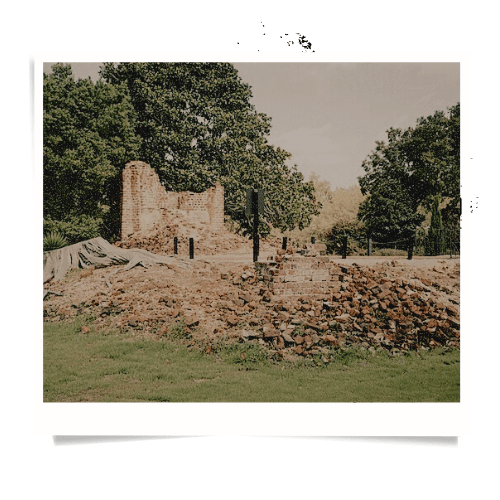
The Linna family did not appreciate the Sundberg family gaining control of the whole Ohto County coastline. Their response was to lay claim to Isa island, which the Sundberg family maintained was part of their estate. The exact details of what followed are lost to the ravages of time. What the New Vaarashire Historical records do show is, that in six month period in the 1881, five members of Sundberg Family and twelve members of the Linna family died of various accidents. At the end of the bloody year of 1881, half of Isa Island was declared a public park, and half was claimed by the Linna family and not contested by the Sundberg family.
Roughly a hundred years later the park was declared a Heritage Park by the New Vaarashire Town Council. The Council recommends that people not camp overnight in the park however, as those who do frequently have traumatic dreams of the members of Sundberg and Linna families who died back in 1881. At least one person dies in the Heritage Park each year despite these warning however, typically with no evidence of physical trauma.
Heritage Conservation Center
A disused Conservation Center sits at the entrance to the Isa island Heritage Park. All signage conspicuously point out that the park was donated by the Linna family and the structures paid for by donations from the Linna Family. Nobody maintains the center, and the moss and sea grass have crept into the center and made it home for sea birds and other small animals. Faded ecology posters flutter in the breeze that whips through the shattered windows and empty door frames. A moldering topographical diorama of Ohto County sits crookedly on three table legs in the center of the center. Mushrooms bloom from rectangular lumps of paper that were once likely books of some sort, but which had long since been reduced to a growing medium for fungus and pill bugs.
A disused service road of gravel and packed dirt winds past the old Conservation Center and leads deeper into the dark heart of the Heritage Park.
Conservation Observation Tower
Visible from the mainland, the Conservation Observation Tower is a monstrous spike of industrial metal stabbing up from the sickly evergreens of the Heritage Park. thick with invasive ivy and berry bushes, the Tower is a creaking swaying skeleton of rust orange and brilliant green. Official estimates put the height of the tower at two hundred and ten feet. Unofficial estimates on the height of the tower vary wildly with no consistent number emerging. Occasionally teenagers will sneak out the Park to have parties, those who return will frequently tell stories about a great dark winged shape they saw perched on the top of the tower as it swayed in the wind.
Island Ranger Station
Volunteers from the New Vaarashire Young Wilderness Rangers still maintain the Ranger Station, and do so with relatively few casualties and only minimal disappearances each year. The Ranger Station is a simple A-Frame Cabin deeper down the dirt road that passes by the corpse of the Conservation Center. The Young Wilderness Rangers make a point to never leave fewer than three Rangers present, lest they disappear with no trace. The Rangers also take care to never staff the the station with more than seven Rangers, lest the cabin be found empty the next day with blood spattered across the the interior of the cabin.
The cabin is surrounded by a six inch concrete moat with grates to drain water. Officially there to prevent internal water damage to the cabin, the Rangers meticulously fill the moat with rock salt when they arrive and take care to never let the salt wash away. Protective Nordic runes have been etched upon all the windows, and the Rangers repaint those runes onto the door and exterior walls at regular intervals. Whenever the Rangers change the guard at the cabin, the incoming Rangers bring new papers marked with the same protective runes, which they staple to the fence posts on the old wooden fence that surrounds the cabin.
Officially, there is nothing on the wooded island that hunts humans. Officially all disappearances are due to accidents and misadventure. Unofficially, people leave offerings of raw meat at a small roadside shrine in front of the Ranger Cabin if they plan to venture further into the Heritage Park.
Isa Island Community Boathouse
The Linna Family staff prevent anyone not affiliated with the family from landing at the Linna Family Private Docks, often using the business end of a double barreled shotgun. And so, just as they maintain the Ranger Station, the Young Wilderness Rangers maintain the Community Boathouse. Arriving via the Community Boathouse is not without risk however, as those offloading deep into the foreboding pine forests of Isa island rather than the more open grounds of the Linna Estate.
The Boathouse is connected to the same dirt road as the Ranger Station and the Conservation Center as is twists and contorts its way through the emaciated and densely packed woodland. Between the Ranger Station and the Boathouse sit a few areas cleared for public camping, with metal fire pots and raised earth for tents to be laid. Between three and five people go missing from the camp sites each year
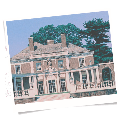
The Linna Family Estate
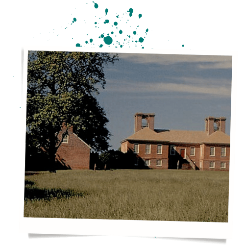
The name of the Linna Family is plastered all over Ohto County. After the Bloody year of 1881, the Linna family set about building their family estate on Isa island and establishing the island as their base of power. Built in the style of a traditional Victorian era Country House, the Linna Family Estate appears to have been dropped into the landscape of Ohto County from a classic Gothic Romance complete with faux period touches including a hedge maze and Victorian style garden. The Linna Family Estate was built with the intent of displaying and projecting power across the valley. Unable to control the coast line and the coast road itself, Isa Island was the Linna family’s show of dominance to the rest of Ohto County.
1951 was the last year when any member of the Linna family was seen in public. The family still extends its influence across Ohto County via the family servants and affiliated corporate organizations. Officially, none of the Linna family have been declared dead since 1951. In fact, keen eyed bureaucrats have noted that no death certificates exist for any member of the Linna family since their arrival in Ohto County. The estate has slowly deteriorated since 1951. Shrubs and hedges have overgrown. Vines and moss have spread across the stone walls and walkways. Sea grass has sprung up between cobble stones, The Linna family estate appears abandoned from all outward appearances. But despite the exterior state of disrepair, employees and servants of the family still work on the Estate and still come and go as they they always have.
The Linna Estate Private Docks
The Linna family estate, though in disrepair since 1951, is still staffed and maintained by the employees and representatives of the Linna family. And all supplies coming into the family come in through the Linna Estate Family Docks. Though the estate is in disrepair, the docks and the fleet of half a dozen boats are well maintained and in good repair. Notably, the phrase: “Näemme Aina Sinut,” is written in white on the black ocean facing wall of the Boathouse. The phrase translates from Finnish as: “We will always see you.”
The Fort Isa Compound
Built shortly after the completion of the Linna Family Estate, the Linna family commissioned the construction of Fort Isa on their property. Built in the style of a colonial era Star Fort, The Linna Family claimed that the fort was to serve as a protective measure for the County. The fort was staffed continuously by the family until 1901. In 1901 an incident occurred that was officially logged as a fire at the Fort and to this day the stones of Fort Isa are indeed blacked by fire.
The Amherst Radio Tower
Following the outbreak of World War one, the Linna family decided that Fort Isa alone would not be enough to protect Ohto County and the Linna family in the event of a surprise attack. They commissioned the Amherst family with erecting a Radio Tower. The tower was outfitted with loudspeakers to broadcast any warnings across the estate. Although no surprise attacks occurred, the radio tower still stands and is still maintained the by the employees of the Linna family. Linna family staff still patrol the border between the Estate and the Park with shotguns and guard dogs. These days thrill seekers will occasionally brave the guards to attempt to sneak towards the radio tower from the Heritage Park. Those who get close will occasionally report strange voices being broadcast from the loudspeakers, voices not speaking English, voices that the witnesses insist do not sound human. None of the witnesses have managed to record the voices broadcast on the loudspeakers.
The Amherst Bunker
Gilbert Amherst arrived in Ohto County early in the written history of the valley and quickly became a loyal attendant to “Old Man” Ensio Linna. Gilbert disappeared the night of Ensio Linna’s murder at the hands of the Sundberg Family. But his family remained loyally devoted to the Linna family and when the family built their estate on Isa Island, the Amherst family was tasked with building a bunker that would serve as a redoubt for the Linna family and its attendants in the event of violent attacks. Dug into the ground a full two stories, nobody unconnected to the Linna family is ever known to have entered the Bunker.
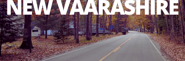
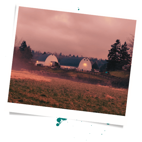
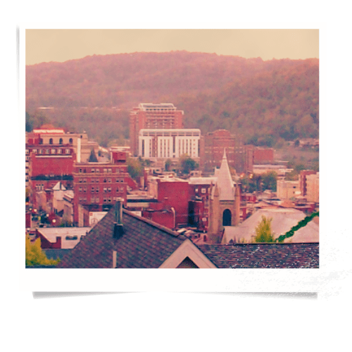
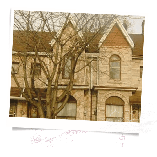
New Vaarashire
Two settlements sit rooted in Ohto County: Hunters Heath in the Elder Warrens, and New Vaarashire that spreads across the Ohto Lowlands and sprawls up into the Katketty region of the Elder Warrens. The Katketty portions of New Vaarashire are typically considered a separate settlement by the inhabitants of the lowland districts of New Vaarashire. The Lowland portions of New Vaarashire were settled and built first, and are comprise the downtown and the most established family estates not named after the Sundbergs or the Linnas. Lowland New Vaarashire is divided into: The Green District, the Red District, and the Old Downtown.
New arrivals to Ohto County will find New Vaarashire to be an anachronistic time capsule, a quaint rural small town that seems to defy matching any actual era by style or construction. New Vaarashire is cozy and creepy, quiet and eerie, and radiates the feeling of a small town with a dark secret.
The Green District contains most of the farmland that produces the food that Ohto County survives upon, and also the Karhu Standing Stones. The Red District contains remnants of attempts through the years at building an industrial district and connecting with the outside world. The Railyard sits in the Red District, with dissolute train cars which will never leave the Lowlands. And in between the Green and Red Districts sits the Old Downtown, with bars and bookstores to distract the inmates of Ohto County from the inevitability of their situation as permanent inhabitants of this impossible place called Ohto County.
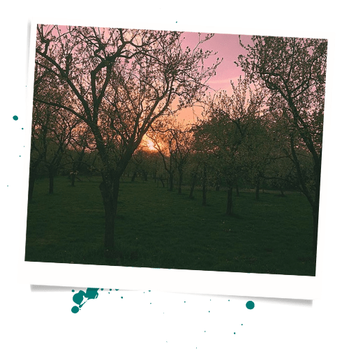
The Green District
The Green District sits between the Coast Roads and the Old Downtown: a collection of orchards growing whatever hardy fruit trees that can survive the bizarre weather and the unforgiving soil of Ohto County. As with so much of Ohto County, the Green District is marked by the conflict between the Sundberg Family and the Linna Family. The Linna Family controls much of the Pernteinen Hills region, while the Sundberg Family controls the Rotting Groves.
Rumors seem to possess a life of their own in Ohto County, as they seem to exists and nobody can seem to recall spreading the rumors in the first place. Rumors abound of strange figures hiding in the orchards and inhabitants of Ohto County will often attempt to scare their children with tales of the Orchard Folk who come out at night and steal children who’ve stayed awake past their bedtime.
The Rotten Groves
Orginally known simply as the Groves; the Linna Family resented losing control of Wu Li Brewing Company and the Happy Devil Orchard and Growers Company to the Sundberg family, and managed to popularize the dismissive name: The Rotten Groves. The name stuck and now sits on official documents.
The Rotten Groves are noted for sightings of the so-called Orchard People or Orchard Folk- small and shadowy humanoid figures which are often seen walking through the orchard and dawn and dusk. The Orchard People are rarely associated with disappearances or mysterious deaths, but are nonetheless frequently represented as bogeymen to children who misbehave.
The Wu Li Brewing Company
Founded at some unknown point in the early history of Ohto County by Freddie Wu, and the brewing company has been owned by the Wu family ever since. The Brewery sits in the center of a massive field where the brewery grows the grain which will be used to make the beer which the brewery sells. For generations, the Wu family was the only Chinese descended family in the entire valley. And during that time, the family cultivated a mysterious and mystical persona. Locals do occasionally debate whether the Wu Family has been genuinely engaged in occult activities or if the whole process has just be an elaborate multi-generational con against the rest of the valley. But whether real or affected, the Wu family is treated with respect and just a bit of fear by most other families in the valley. Even the Linna and Sundberg families choose not to cross them.

Hannah Wu, the current owner of the Wu Li Brewing Company and de facto head of the family is trying to help her family shed their old image. Hannah wishes to recreate the Wu family as a modern business institution. But old habits die hard, and Hannah’s father Dominic Wu still operates a classic Apothecary out of his house on the property. And much to Hannah’s consternation, other locals still show up at her father’s house late in the evening for miracle cures and magical powders.
The Happy Devil Orchard and Growers Company
Residents of Ohto County often speculate on whether the Happy Devil Orchard and Growers Company was named as a result of the shadowy Orchard People who supposedly stalk among the fruit trees, or if the Orchard People are somehow the result of goings on at the ill named Happy Devil itself. Officially named after the founder: ‘Happy’ Bob Devlin, The Happy Devil has passed through numerous hands over the years. Nobody has maintained ownership of the company for more than twenty years in total. Happy Devil sells both soft and hard ciders and the office at the orchard itself is notorious for not checking the IDs of young people purchasing a mix of soft and hard ciders. More than one Ohto County youth has woken up in the orchard with a terrible hangover and no idea how they arrived there in the first place. The Happy Devil name is associated with mischievous fun in the minds of the locals. Only a few people disappear in the orchard grounds every year compared to other mysterious locations in the county. Most people who stumble drunkenly between the apple trees as dusk falls will stumble back out in the early morning light. And the locals appreciate the fact that the orchard people exact so small a price on the people.
Perinteinen Hills
Named by the Linna Family, the entirety of the land making up the Perinteinen Hill is owned by the Linna Family. The Patara Family who owns Schezerade Farms lease the land for their farming from the Linna Family and have now for generations. The Linna Family likewise owns the land upon which the Old Temple Community Center sits, and in fact both own and built the Old Temple structure itself. The town council has grappled with the Linna Family over ownership of the Karhu Standing Stones; which the council maintains should be a historical heritage monument, but which the representatives of the Linna Family refuses to turn over to community.
Scheherazade Farms
Scheherazade Farms is owned by the Patara Family, a Sikh family who fled the Punjab province during the partition of India and Pakistan and the resulting chaos and violence. The land upon which Scheherazade Farms sit is owned by the Linna Family, and the Patara family leases said land. The Patara family could almost be thought of a vassal family to the much for powerful Linna family, and most of the locals treat the Patara family as simply part of the Linna family anyway. The name for Scheherazade comes from the narrator of A Thousand and One Nights, and springs from the largely causasian residents misunderstanding the Patara family’s cultural background. Despite the obvious error, the name stuck and the family ran with the misunderstanding after failing to correct it.
Scheherazade Farms supply much of the fresh produce and dairy for the valley. Shipments of processed food does arrive by train and truck from outside the valley, but nobody quite seems to known how this occurs. And nobody has ever managed to escape the valley on an outbound train and sixteen wheeler. As such, many new arrivals avoid the packaged food of mysterious origins and live primarily on food grown at Scheherazade Farms. Better safe than story, the logic goes. Of course, this also makes the new arrivals even more dependent upon the valley for their survival. Safety comes with sacrifice.
The Old Temple Community Center
The Old Temple Community Center serves as the primary gathering place for public events in New Vaarashire. Ostensibly the building was originally built as a church. However, the building does not look like a church devoted to any Christian denomination. Instead, the Old Temple Community Center looks not unlike a Victorian interpretation of an Egyptian Temple to Ra. Any religious decorations have been long since removed, but the structure still bears the aura of the occult. The Linna Family owns the land upon which the Old Temple Community Center sits. The Linna Family also built the Old Temple structure itself. Technically the Linna family still owns the building, but has agreed to allow the town to use the structure as a municipal building on an ongoing basis.

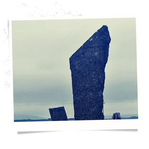
The Karhu Standing Stones
Truly bizarre are the European style Karhu Standing Stones found in the valley, dating to some nine thousand years ago. Native Americans in the neighbouring regions described them as not having been built by people when questioned about the stones. Stories from neighbouring tribes describe the region as previously inhabited by various groups of beings, spirits or giants or monsters, of varying degrees of power and hostility. No human remains dating before the arrival of European settlers have been found in the region, except around edges of what is generally considered the border of the County. At the fringes, surprising amounts of humans remains have been found, some dating back over thirty thousand years, which is much in dispute in the Archaeological community.
The Old Downtown
The buildings on the Broken Coast are older than any part of New Vaarashire, but it is the Old Downtown that is the oldest part of the town itself. New Vaarashire grew up around the Townhall,. The town hall was originally used as a church or a beer hall, accounts vary. Likewise, locals can’t agree on who built the town hall or who owned it when it was built. The Town hall and the Cenotaph are owned by the town itself. But all other buildings in the Old Downtown are owned by small businesses. Neither the Sundberg family nor the Linna family claim to have built any of the buildings in the Old Downtown, and today the Downtown sits as an independent island in the territorial cold war between the two families.
South Slope
New Vaarashire’s downtown was built upon a rise in the terrain. As the town expanded, people built down the that rise towards the Katketty River. And so the portion of New Vaarashire earned the terribly original moniker of the South Slope. Home to both the town Truck Stop and the Town Public House, the South Slope is as close to being the wrong side of the tracks as one can get without being in the Katketty.
The Truck Stop
The New Vaarashire Truck Stop, literally named: The Truck Stop. The truckers are easily divided into two groups: the locals who deliver within the value, and the outsiders who bring in supplies from outside the valley. The outside drivers rarely speak and look just slightly wrong if viewed in the clear light of day.

The Beast and Shepherd
The Beast and Shepherd is a bar, owned by the Shepherd family since 1910. The Beast and Shepherd mostly serves alcohol from the Wu Li Brewing Company and the Happy Devil Orchard. But The bar also serves two specialty drinks: The Beast, and the Shepherd. The Beast is a cocktail composed of vodka, hot peppers and ginger syrup. The Shepherd is an alcoholic milkshake that incorporates bananas and peanut butter.

The Core
The oldest portion of New Vaarashire, the core has a old world turn of the century look to its architecture. Shadows loom and pool as the sun passes over the Core. The Core seems to collect shadows, even at high noon, and things seem to lurk in those shadows- moving when people look away.
The Rook Hotel
Built from an old Edwardian estate house, the rook hotel is a three story brick building caked in moss and climbing vines. The Rook prominently advertises itself as ghost free and displays a certificate of recent exorcism at the front desk.
The Sleeping Beast Bookstore
The Sleeping Beast is a family owned bookstore, which has been operated continuously since 1910 by members of the Shepherd family. Sitting in front of the shop is a massive wooden sized chainsaw sculpture of a seven headed dragon, the beast for which the shop is named.

Town Hall
The oldest civic building in Ohto County, the Town Hall serves as the seat of government, the Sheriff’s office, and the Courthouse.

The Cenotaph
The town of New Vaarashire has a Cenotaph. The Cenotaph itself is unremarkable in construction. However, the Sherriff’s department has to run off vandals at least once a month. Local rumor names the Cenotaph as the site of either old man Linna’s final resting place or the mythical sword known as Tyrfing.

The Red District
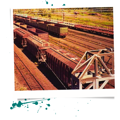
The Red District is the industrial district of New Vaarashire, dominated by the railyard and the scrap salvage yard, but the Linna Family Mill makes the influence of the Linna family inescapable here. Fights between blue collar workers who align with one of the families or with neither are frequent. New arrivals are advised to avoid the neighborhood after sundown, due to threat of violence rather than any superstitions.
The Rust Yards
The Rust Yards is the name given for the section of the Red District that is nominally free of the influence of the Linna Family.
Old Lincoln Railyard
Nobody knows where the trains come from. Nobody knows the train employees who unload the trains. And people don’t ask too many questions either, as the trains supply necessary resources to the valley and nobody wants to risk the lifegiving supply of goods that ride the rails. Occasionally the Hunter’s Club will report bodies showing no obvious signs of death near the rail lines around the edge of the valley. People generally assume that this is what happens when one stows away on a train car, but nobody knows for certain.
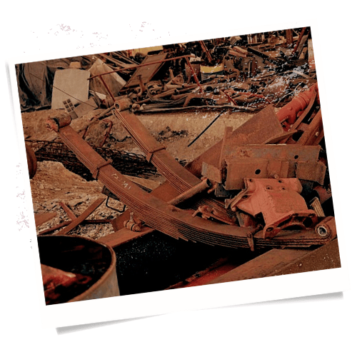
Old Lincoln Scrap Salvage Yard
As nothing arrives in the valley that didn’t arrive with a new arrival or on the rail, the salvage business is critical to the survival of the valley’s community. The Old Lincoln Scrap and Salvage Yard maintains its independence from both the Sundberg and the Linna Families because neither can afford to risk the Scrap Yard ceasing the work it does.
The Cedar Hills
A stand of great old cedar trees once stood at the site of the Linna Family Mill. Long turned into lumber by the mill, the district still bears the name Cedar Hills.
The Linna Family Mill
Crucial to the early development of New Vaarashire, the Linna Family Mill, and thus the Linna Family, still dominate the construction business in the Lowlands.

The Elder Warrens
Those who find themselves in the Ohto Lowlands will frequently assume that they can escape Ohto County by heading inland. Heading inland the new permanent inhabitants enter the Elder Warrens, the upland regions leading in to the Mountainous regions the box in the county.
According to the Tourism Guides, Ohto County is most easily reached by water, with early settlement occurring on Isa Island and in the Karhu Delta Region as a result. The Lesser Hirvi Mountains that wrap around the valley are not easily crossed and the only road connected Ohto County with the outside world is the Sundberg Coast Road. To the east of the Karhu Delta Region lies the Region know as the Elder Warrens: a rocky boreal forest region that climbs up into the Lesser Hirvi Mountains and forms the the outer teeth that ring Ohto County and separate it from the outside world.
The Elder Warrens is divided into the lowland Katketty River Region and the upland Lesser Hirvi Mountain Regional Park. The Katketty River Region is notable for Black Lake and the Katketty River. The Lesser Hirvi Mountain Regional Park is notable for Quiet Quarter containing the park itself and the small unincorporated village of Hunter’s Heath, and the Waste Woods: a section of forest ravaged long ago by some unknown pest or illness and where few dare travel.
The Katketty River Region

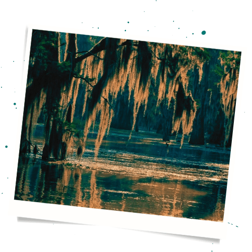
One of the strangest features of the valley is that strange and changing nature of the ecology there. Those familiar with the Pacific Northwest Coast will see much in common there with the Broken Coast. Further inland, one couldbe forgiven for mistaking the New Vaarashire region for New England. And as one enters the Katketty River Region, the ecology changes again. The Katketty feels like the a mishmash of the Florida everglades and the Louisiana bayou. Cedar Trees drope over swamp ground that frequently simply disappears beneath stagnant water. The Katketty flows lazily inland and flies and mosquitos swarm thick and bloody in the damp air. The people who live in the Katketty Region, do so to avoid the scrutiny of the Linna and Sundberg Families and the tyranny of the Hunter’s Club. Ungovernable, and unwelcoming to new arrivals, the Katketty folk keep to themselves and keep their secrets.
The Lake Shore
To the west of New Vaarashire, the Black Lake sits as an informal border between New Vaarashire to the Northwest, the Katketty River Region to the southwest, and the Lesser Hirvi Mountain Region to the east. The area referred to as the Lake Shore sits on the western and southern borders of the Black Lake.
The Lake District
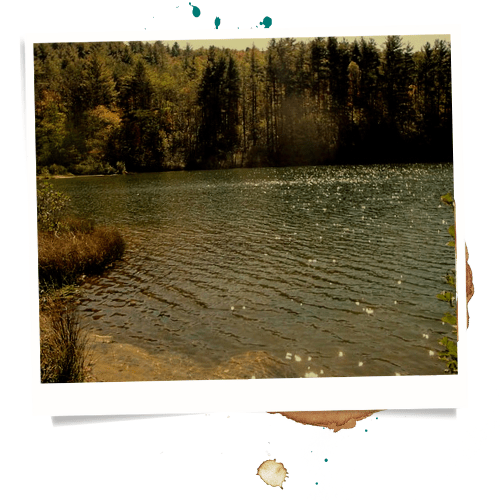
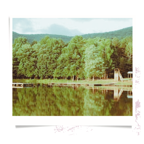
The Black Lake
The Black Lake is the primary source of recreation in the summers. New Vaarashire folk come down in droves. They rent fishing gear from Trollmouth and line the reed clogged shoreline from May through September. That said, the Black Lake is as much a source of superstition as any other location in the valley. Locals report seeing a demon or dark female figure in the lake during winter months, and fishing is rare once the air turns cold.
Trollmouth
The Road leading from New Vaarashire to Hunter’s Heath crosses the Katketty River just south of the Black Lake. The site of the bridge is referred to as Trollmouth and is the site of a Fishing Lodge and Tackle Shop that serves the people who visit the lake to go fishing or boating. There have been no reports of trolls in sixty years.
The South Shore
Technically the South Shore or New Vaarashire, the folks who live on the southern side of the Katketty River tend to refer to the location as The Katketty (not the Katketties, they are very particular).
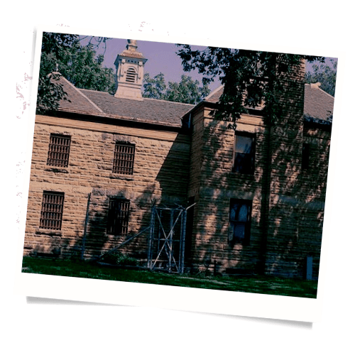
The Jailhouse District
The Jailhouse District is so named, because it is the location of the County Jail- built in the middle of the Municpal reserve. The whole district is an open marshland, where criminals attempting to escape must slog through hip deep mud amidst cattails and wild rice.
Jokipesa Marshlands
Technically the Jokipesa Marshlands encompasses the whole Jailhouse district and parts of the adjacent areas besides. Nonetheless, people tend to refer to only the area outside the Municipal Reverse as the Jokipesa Marshlands. The Jokipesa Marshlands is home to the Jokipesa Trailer Park and the haphazardly built river houses of the Kaketty folk.
The Municipal Reserve
Nobody lives in the Municipal Reverse. A half submerged chain link fence topped with razor wire weaves around the border of the Municipal Reserve. The fence sits fully submerged in some areas. Signs warn trespassers that they are entering government property and that trespassers will be stopped and questioned. At the center of the Municipal reserve sits the County Jailhouse.
Weeping Widow Heritage Park
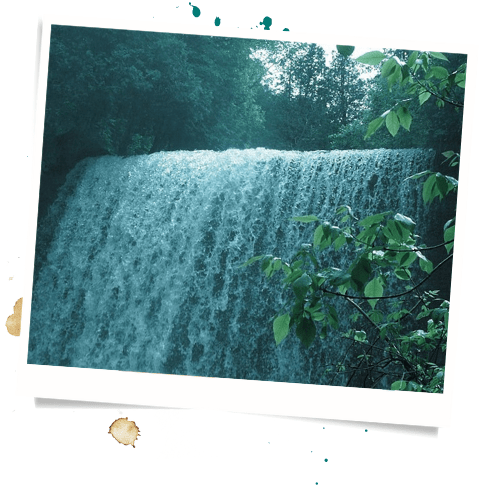
Rumor has it that Weeping Widow Falls and the park within which it sits are named after the wife of Einar Sundberg, who supposedly committed suicide by leaping from the falls following the murder of Einar by the Linna Family. Einar was never formally married, and the supposed name of his widow changes with each telling.
Atlai Forest
The land of the Altai Forest rises up above the marshes of the rest of the Katketty River Region. Here old growth cedar forest rise to colossal heights and moss coats the ground like a sound baffle muffling the approach of lynx and bobcat. The sun streaks down and small mammals scurry in the undergrowth. The Atlai forest feels alive and feral, “nature wild in tooth and claw.”
The Altai Sunburst Youth Camp
Owned by the Sundberg Family Trust, the Altai Sunburst Youth Camp is the principal place for well to do New Vaarashire parents to dump their children during summer months. Altai Sunburst Youth Camp has had very few deaths or mysterious disappearances in the past seven years.
Weeping Widow Falls
Rumor persists that the falls was named after the widow of the first death in the Linna-Sundberg feud: Einar Sundberg. The Sundberg family denies this, but rumors persist. And young lovers frequently pledge their devotion at the bottom of the falls.
The Linna Plantation Grounds
Some food arrives in Ohto County by the railyard through mysterious means. But the Linna Plantation provides a huge portion of the of corn and wheat that the county eats. Between the Plantation and Schehezarde Farms, the Linna family controls nearly all the food in the valley that wasn’t freshly killed by the Hunter’s Club. The Linna Family denies ever using indentured prisoners from the County Jailhouse to man their plantation.
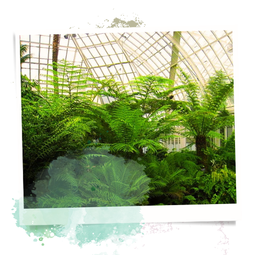
The Linna Memorial Conservatory
Following the Bloody Year of 1881, The Linna Family erected a conservatory on the Plantation Grounds as a memorial to the members of the Linna family who died. The Linna Memorial Conservatory is open to visitors. Statues commemorate dead members of the family with plaques full of hagiography and bluster.
The Lesser Hirvi Mountain Regional Park

The Lesser Hirvi Mountains are not notably high, nor particularly picturesque. The Lesser Hirvi are notable for being difficult to navigate. A dense Boreal forest has taken root in the mountain’s rocky unforgiving soil, hiding the skyline above and the uneven ground below. The mountains are still young, pushed up by tectonic action and leaving sharp cliffs and steep jagged slopes. A person who had visited the Appalachians would find the Lesser Hirvi Mountains feel very similar ecologically.
The Quiet Quarter
The Lesser Hirvi Region is divided into two sub-regions. The Quiet Quarter is sparsely settled, and the Empty Quarter is not settled. The Quiet Quarter is the location of Hunter’s Heath, the other notable settlement in the valley. The Quiet Quarter is governed by the Hunter’s Club, and their word is law. Visitors are treated coldly, and trespassers go missing.
Hirvi Mountain Recreational Parklands
The Linna Family Hunting Grounds
When Arawn Lincoln died, and Voitto Taikuus took control of the Hunter’s Club, the Linna Family attempted to move in and take control of the region. The family reasoned that with a fellow Finn in charge of the Hunter’s Club, it would be eager to align with the Linna Family. They were wrong. To this day, the only portion of the Regional Park which remains under Linna Family control is their Hunting Lodge and the careful negotiated family hunting grounds.
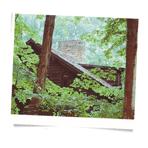
The Linna Family Hunting Lodge
The last foothold of the Linna Family in the Elder Warrens, the Linna Family Hunting Lodge is subject to all sorts of dark rumors. New Vaarashire folk speculate on what or who the Linna Family hunts on their visits to the Hunting Lodge.
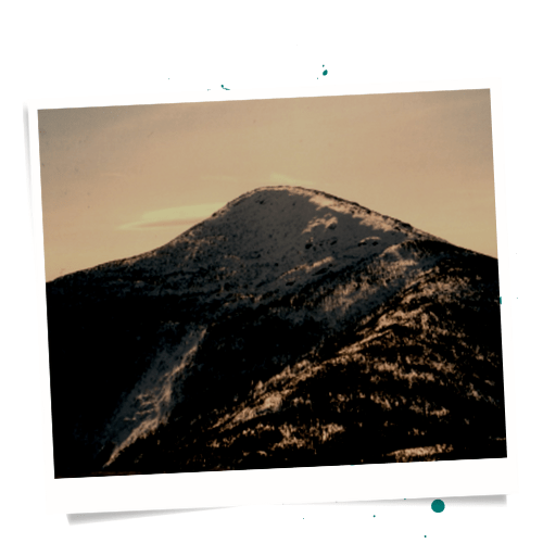
Taikuus Peak
The Hunter’s Club did not want to give up control of Taikuus Peak, the highest peak in the Lesser Hirvi Mountains. Rumors swirl as to why they eventually allowed the peak to be included in the Linna Family Hunting Grounds.
Old Taikuus Alpine Woodlands
Voitto Taikuus, the second president of the Hunter’s Club, did much to improve the Parklands. He opened up the region to visits to inhabitants of New Vaarashire, in order to bring in a little money for the inhabitants of Hunter’s Heath. Even today, acting as hunting guides for the rich and powerful of New Vaarashire is how Hunter’s Heath makes their meager income.
Radar Station
A massive abandoned radar station of mysterious origin and indeterminate age, the Radar station appears to be from the Cold War era, but nobody seems to know who built or when it was abandoned.

Park Ranger Station
As with the Ranger Station on Isa Island, the Elder Warrens Ranger station is manned by volunteers. But in this case, the volunteers are junior members of the Hunter’s Club, and fatalities on the job are an expected part of the initiation process.
Hunter’s Heath Unincorporated
Bopth Hunter’s Heath and The Hunter’s Club were founded by Arawn Lincoln. Here the Hunter’s Club keeps their secret headquarters. And here the toughest and grimmest inhabitants of the valley live. Hunter’s Heath expels those the Hunter’s Club deems unworthy. The spartan little town is thus populated by those who both wish to live away from New Vaarashire and can measure up to the expectations of the other inhabitants.

Old Lincoln
Named after Arawn Lincoln, the founder of Hunter’s Heath and the Hunter’s Club, Old Lincoln is the oldest part of Hunter’s Heath.
Old Lincoln Veterans Center
Although Ohto County sent no soldiers out to fight in any wars, owing to an inability to leave, veterans for many wars have ended up unwilling immigrants in the valley. Those veterans tended to migrate to Hunter’s Heath. In 1959, Luther Brown jr., the fifth president of the Hunter’s Club ordered the building of the Old Lincoln Veteran’s Center to provide support to the veterans.
The Sisters of Saint Agatha Convent
A rare source of Christian iconography in the otherwise very pagan feeling Hunter’s Heath, The Sisters of Saint Agatha Convent serves as the local volunteer fire department in addition to its duties as a convent. The Sisters of the convent are also the builders of the Sacred Taikuus Bell Towers.
The Statue of The Missing Child
Children go missing in Ohto County. This is a fact of life for the inhabitants. The Statue of the Missing Child is in in memory of all child who have gone missing, not unlike a tomb for the unknown soldier.
Old Taikuus
Named after Voitto Taikuus, the second president of the Hunter’s Club, Old Taikuus includes the Plantation Ruins where the Linna Family attempted to claim part of Hunter’s Heath. The plantation is now deserted.
The Sacred Taikuus Bell Towers
Seven Bell Towers form a crescent around the south border of the Old Taikuus Neighborhood. Built by the Sisters of Saint Agatha and run on Sundays, the bell towers are climbed by children the rest of the time as tests of bravery. Falls are common, though seldom fatal.
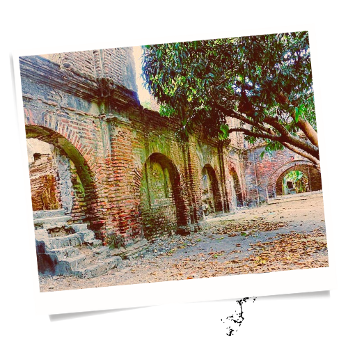
The Plantation Ruins
The Linna Family built a second plantation in the region following the ascension of Voitto Taikuus to president of the Hunter’s Club. After this, the Hunter’s Club engaged in a campaign of guerilla vandalism and sabotage until the Linna Family agreed to withdraw from the Elder Warrens, retaining only their Hunting Lodge and the adjoining lands. Today the Plantation sits moldering in ruins. The area is considered cursed by the locals, and strange sightings and disappearances are common.
The Empty Quarter
The Quiet Quarter has few inhabitants. The Empty Quarter has none, as far as anyone knows. The terrain is unwelcoming. the vegetation is sickly and threatening. And little larger than a rat seems to live in the Empty Quarter. It is unfriendly ground.
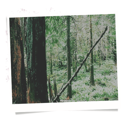
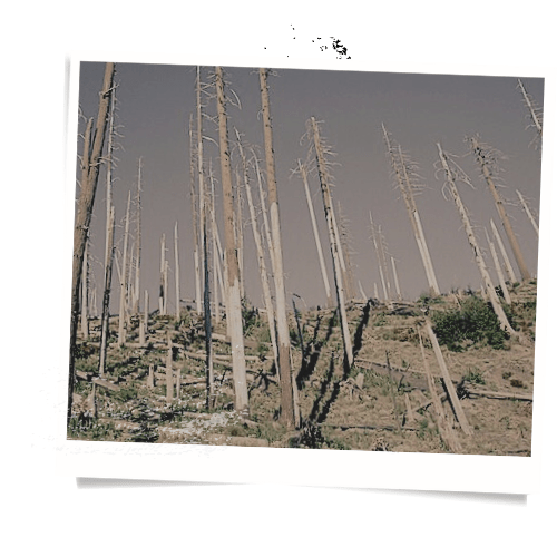
The Waste Woods
Dominating the Empty Quarter is the Waste Woods, a vast stand of dead or petrified trees. The cause of the death of all the trees in the region is unknown, as is the source of the petrified trees. The petrified trees are scattered through the Waste Woods in a manner not in keeping with what paleobotanists would expect. This has led to speculation that the trees are in fact not petrified, but changed to their current state through some other process as yet unknown to science.
The Poison Forest
The Poison forest sits at the center of the Waste Woods and has the highest concentration of petrified trees in the Quarter.

The Ritual Grounds
At the center of the Poison Forest sits a clearing with a circle of fallen petrified logs within which sits a half circle of seven upright petrified trees.
The Blasted Heath
On the south border of the Waste Woods lies the Blasted Heath, a region where at some point some fire or explosion has burned and sterilized the land to such an extent that nothing grow there to this day.
The Grey Shrine
On the southern edge of the Blasted Heath, right at the border of where even the Hunter’s Club dares venture, sits the Grey Shrine. The Grey Shrine sits in a cave carved into a small hill at the southern edge of the Lesser Hirvi Mountains. The shrine is a small stone altar carved from smoky quartz, upon which sits a soap stone carving of a goat. The goat statue has been stolen by various individuals over the years. The goat always returns. The Hunter’s Club leaves offerings at the Shrine on the first full moon of the new year.